
One platform · Three applications
Turn physical-world data into clearer decisions
ViSNET AI is an infrastructure intelligence platform for teams that own critical assets, sites and buildings. It converts visual data from CCTV, drones, mobile devices and 3D capture into inspection findings, workforce records and project forecasts — in one system instead of three disconnected ones.
Connected intelligence
Capture
Inspection imagery, CCTV, mobile, drones and spatial capture.
Analyze
AI vision, spatial context and operational data in one model.
Act
Reports, alerts, workflows and decision support for the team.
One capture layer feeds all three applications — nothing is re-collected per product.
- Who it serves
- Infrastructure owners, EPC and construction teams, industrial operators, property operations.
- What it uses
- Existing CCTV, drone and mobile imagery, sensors, VR/MR spatial capture.
- What you get
- Defect records, digital twins, workforce analytics, project forecasts, automated reports.
The problem
Inspection, workforce and project data rarely live in the same place
Inspection teams produce reports. Attendance sits in registers or access systems. Progress is tracked separately again. Each system is defensible on its own, and together they leave no single view of what is happening on an asset or a site.
Findings arrive late
Manual review of inspection imagery is slow, and results vary between inspectors and visits.
Workforce visibility is retrospective
Registers and access logs answer who was counted, not who is on site now or which trades are short.
Risk is discovered, not predicted
Without condition history and workforce trends, delays and deterioration are noticed after they matter.
How it fits together
From the physical world to a decision, in one chain
Every ViSNET application draws on the same capture inputs and the same intelligence layer. That is what makes the three applications one platform rather than three products that happen to share a logo.
- 01
Physical world
Bridges, plants, sites, buildings, workforce and work in progress.
- 02
Visual data capture
Existing CCTV, drones, mobile devices, sensors and VR/MR spatial capture.
- 03
ViSNET AI intelligence layer
Computer vision, spatial reconstruction and analytics that turn imagery into structured records.
- 04
Applications
Infrastructure Intelligence · MRLAYOUT · EHS & Workforce Intelligence.
- 05
Workflows and decisions
Inspection reports, attendance records, digital twins, forecasts and alerts inside existing operations.
Applications
Three applications on shared infrastructure
Start with the workflow that hurts most today. Select an application to see the interface it produces — the data model, capture pipeline and spatial layer stay shared underneath.
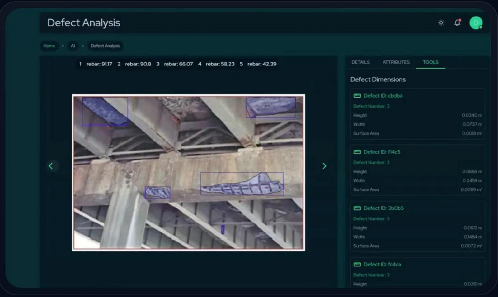
Turn bridge, plant and utility survey imagery into classified, dimensioned and priced defects that stand up in a budget review and can be trended year over year.
- Detect cracks, spalling, rebar exposure, corrosion and efflorescence
- Quantify height, width and surface area to the millimetre
- Severity scoring, repair cost estimation and audit-ready reports
The spatial layer
MRLAYOUT is the visual layer across the platform
MRLAYOUT creates a measurable 3D representation of a space or asset. Findings from the other applications are meant to be read in that context — a defect on the actual structure, activity in the actual space — rather than as rows in a separate report.
In a single 3D environment
- Review defects located on the asset they were found on
- Take and validate measurements against as-built dimensions
- Overlay inspection and maintenance tasks onto the space
- Track how condition changes between capture dates
- Share a model through a browser link, without extra hardware
- Export to CAD, BIM, DWG, IFC and GLB for downstream systems